Every direction. Every height. One flight.
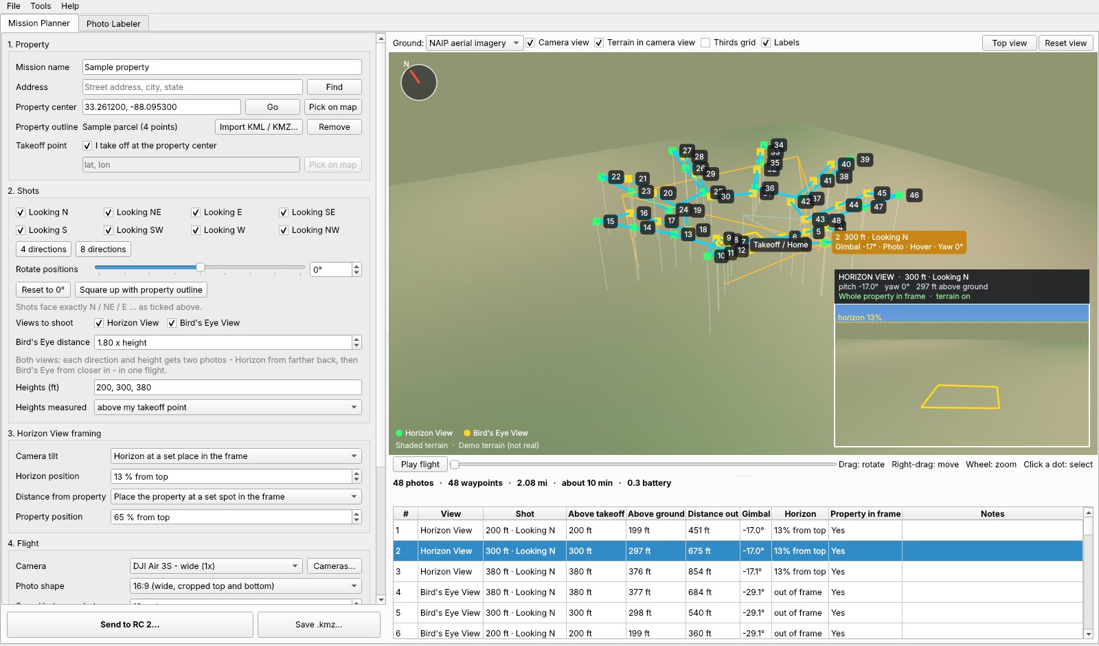
COMPASS builds the real estate drone mission you fly every week: 4 or 8 directions, the heights your client asked for, the horizon where you want it. Then it labels the photos for you.
Windows 10 and 11. Missions open in DJI Fly on waypoint-capable DJI drones.
Each stop is flown at 200, 300 and 380 ft.
From the address to labeled photos
Set it up once, save it as a preset, and the next job takes a couple of minutes.
Plan
Type the address or drop the property KML. Tick the directions and type the heights: 200, 300, 380.
Check
Fly the route in 3D on real terrain. Click any stop to see what the camera will see, and whether the whole lot is in frame.
Send
Plug in the RC 2 and press Send. COMPASS writes the mission into DJI Fly and reads it back to confirm.
Label
Point it at the photo folder. Every copy gets its height and direction stamped on, and an optional new name.
Two kinds of shot, flown together or apart
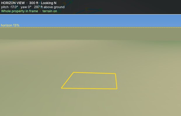
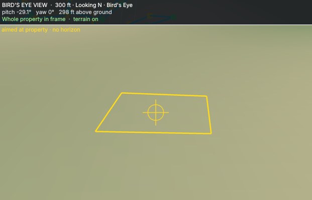
Tick one, the other, or both. With both, each direction and height gets two photos in the same flight.
Horizon View
Farther back and tilted up, so the horizon sits where the listing agent wants it. Set it as a percent from the top of the frame.
Bird's Eye View
Closer in, with the camera aimed straight at the property. No sky, all lot.
Photos that say where they were taken
COMPASS reads the height and heading DJI saves in every photo and prints them on a copy. Your originals are never touched.
- Label text
- Build it from fields like {alt_ft}, {dir_word}, {address} and {date}.
- Look
- Your font, size, colors, outline, position, an optional dark box, compass arrow and logo.
- Rename
- Optional, for example 123_Main_St_300ft_NE_004.jpg.
- Missed-shot check
- Compares the folder with the mission and lists any shot that was skipped.
- Contact sheet
- One PDF of the whole set, grouped by height and direction.
Pricing
Every plan starts with 14 days free. PayPal holds your payment method and charges nothing until the trial ends. Cancel before then and you pay nothing.
You're subscribed
Your license key is on its way to the email on your PayPal account. Download COMPASS, open it, and paste the key in.
Monthly
$9.99 a month
- Everything in COMPASS
- Use it on 2 computers
- Cancel any time in PayPal
Annual
$49.99 a year
- Everything in COMPASS
- Use it on 2 computers
- About $4.17 a month, less than half the monthly price
Prices in US dollars. Your subscription renews automatically. Manage or cancel it in your PayPal account under Settings, Payments, Automatic payments. COMPASS keeps working until the end of the time you paid for.
Questions
Which drones does it work with?
DJI drones that fly waypoint missions in the DJI Fly app, such as the Air 3, Air 3S, Mini 4 Pro and Mavic 3 series. It has been flight-tested on an Air 3S with the RC 2. You can add your own camera if yours is not on the list.
Does COMPASS fly the drone?
No. It writes the mission file that DJI Fly runs. You stay the pilot in command: check every mission on the controller before you fly it, and keep the drone in sight.
Do I need a Mac version?
COMPASS runs on Windows 10 and 11 (64-bit). Sending a mission straight to the controller uses Windows' own USB file transfer.
Can I use it on more than one computer?
Yes, on 2. To move it to a new computer, use Help, License, Remove this computer on the old one.
What happens when the trial ends?
PayPal starts the plan you picked. If you cancel during the 14 days, you are not charged.
Will it keep me under 400 ft?
Heights in DJI Fly are measured from the takeoff point. COMPASS checks the ground at every stop and warns you when a shot would be more than 400 ft above the ground below it.